Difference between revisions of "File:Figure 2.3.1.png"
Jump to navigation
Jump to search
(No difference)
|
Latest revision as of 18:17, 27 February 2023
Figure 2.3.1—Screen capture from the Forest Service Air Resource Management Program online tool showing ozone monitoring site locations for the Boundary Waters Canoe Area Wilderness.
File history
Click on a date/time to view the file as it appeared at that time.
| Date/Time | Thumbnail | Dimensions | User | Comment | |
|---|---|---|---|---|---|
| current | 18:17, 27 February 2023 | 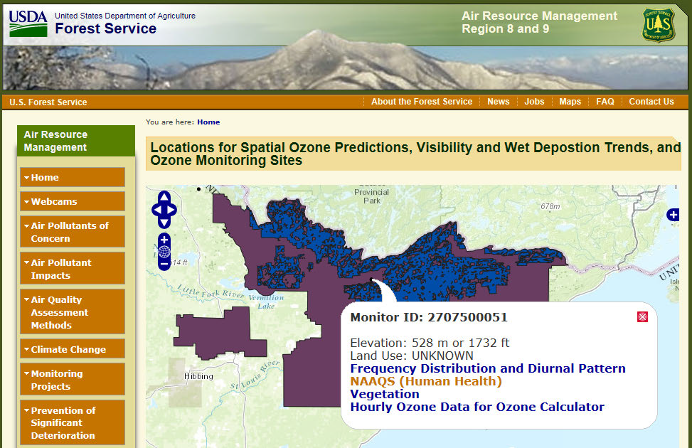 | 973 × 630 (657 KB) | Admin (talk | contribs) |
You cannot overwrite this file.
File usage
The following page uses this file: